Tienda24hs-Security-cctv-ip-camera-technology-D... Drones - Rpas Yuneec UAV Yuneec H520 RTK real-time kinematics
Yuneec H520 RTK real-time kinematics
Product no.: 180264-yuneec-h520-rtk-hexcópteroPrice incl. VAT, plus delivery
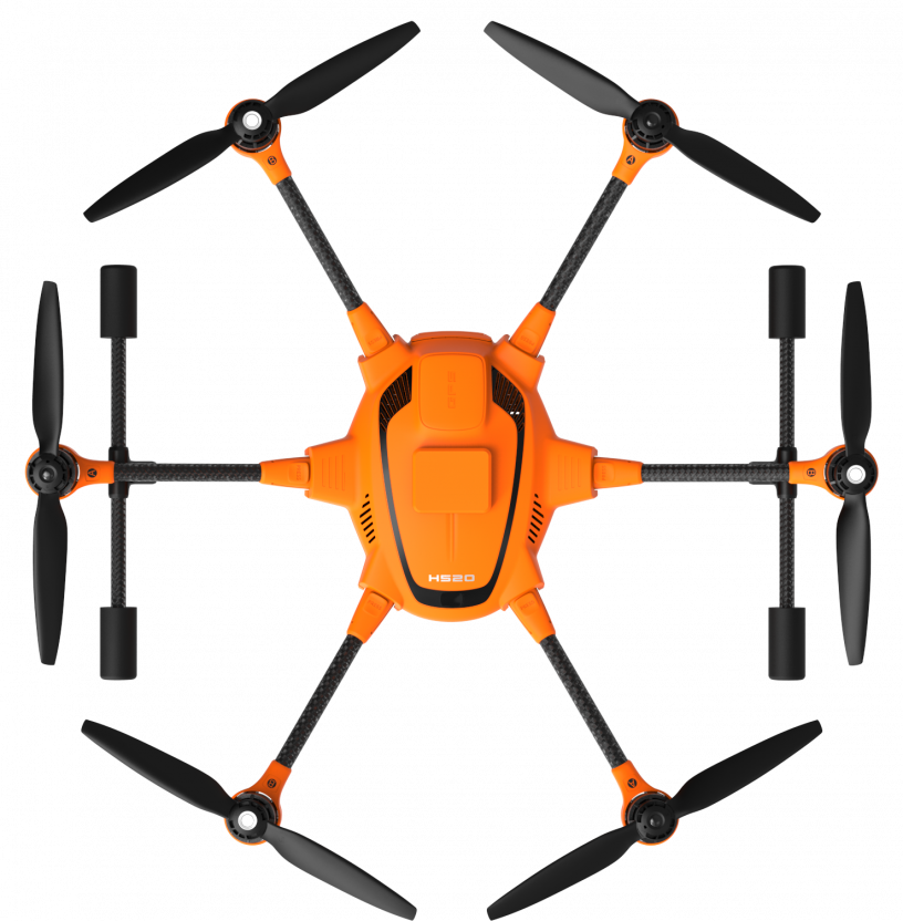


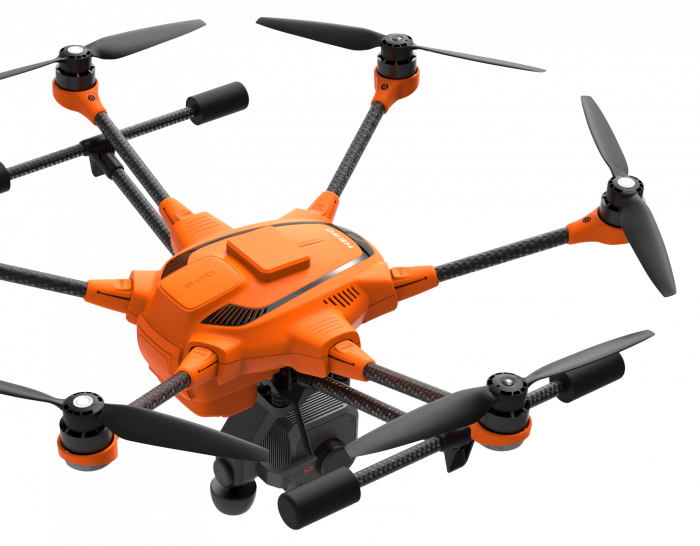
New Yuneec H520 RTK (real-time kinematics) with 2 batteries of 15,2V 5250 mAh and a remote control ST16S YUNH520RTKEU
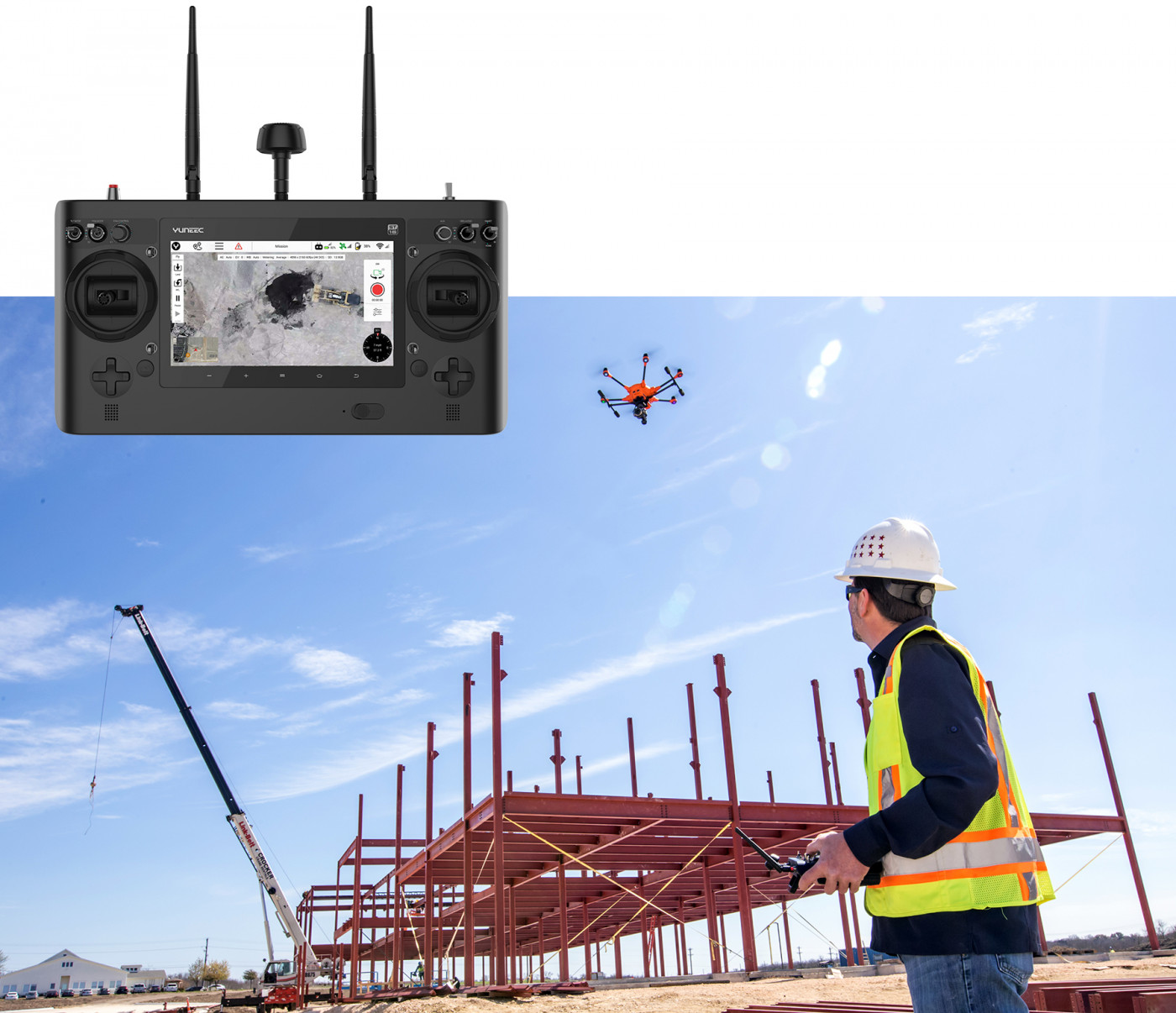
Yuneec H520 RTK (real-time kinematics) works with 2 components, an RTK module on board the H520 and a base station that can reach centimeter accuracy in less than 30 seconds, even in conditions with a difficult GPS signal. It incorporates 2 batteries of 15,2V 5250 mAh and a remote control ST16S with Android operating system.
H520 RTK (Real Time Kinematics)
Accuracy of centimetric level thanks to the Real Time Kinematics (Real Time Kinematics)

The H520 incorporates one of the fastest and most reliable RTK systems in the world, developed by Swiss company Fixposition. Fully integrated in the H520, it guarantees maximum precision and the fastest possible operational preparation even in difficult GPS conditions such as in cities, canyons or forests. With Real Time Kinematics satellite navigation, the new H520 RTK can be kept in the air with centimeter precision, allowing for extremely accurate repetitive photos, faster 3D mapping and more accurate and automated inspection flights.
The H520 RTK is available as a complete system, or it can be updated by our Technical Team to the RTK version, with the same features.
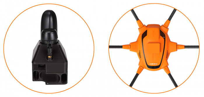
2 components for centimetric positioning
It works with 2 components, an RTK module on board the H520 and a base station. In less than 30 seconds you can achieve a centimeter accuracy, even in difficult GPS signal conditions (compared to the base station). Absolute global centimetric precision and in case you do not want to use a base station, the system can also be operated with a reference station of the RTK network (Through an external provider, so you need an internet connection and it is possible that additional fees apply).
Real Time Kinematics –
Aplications
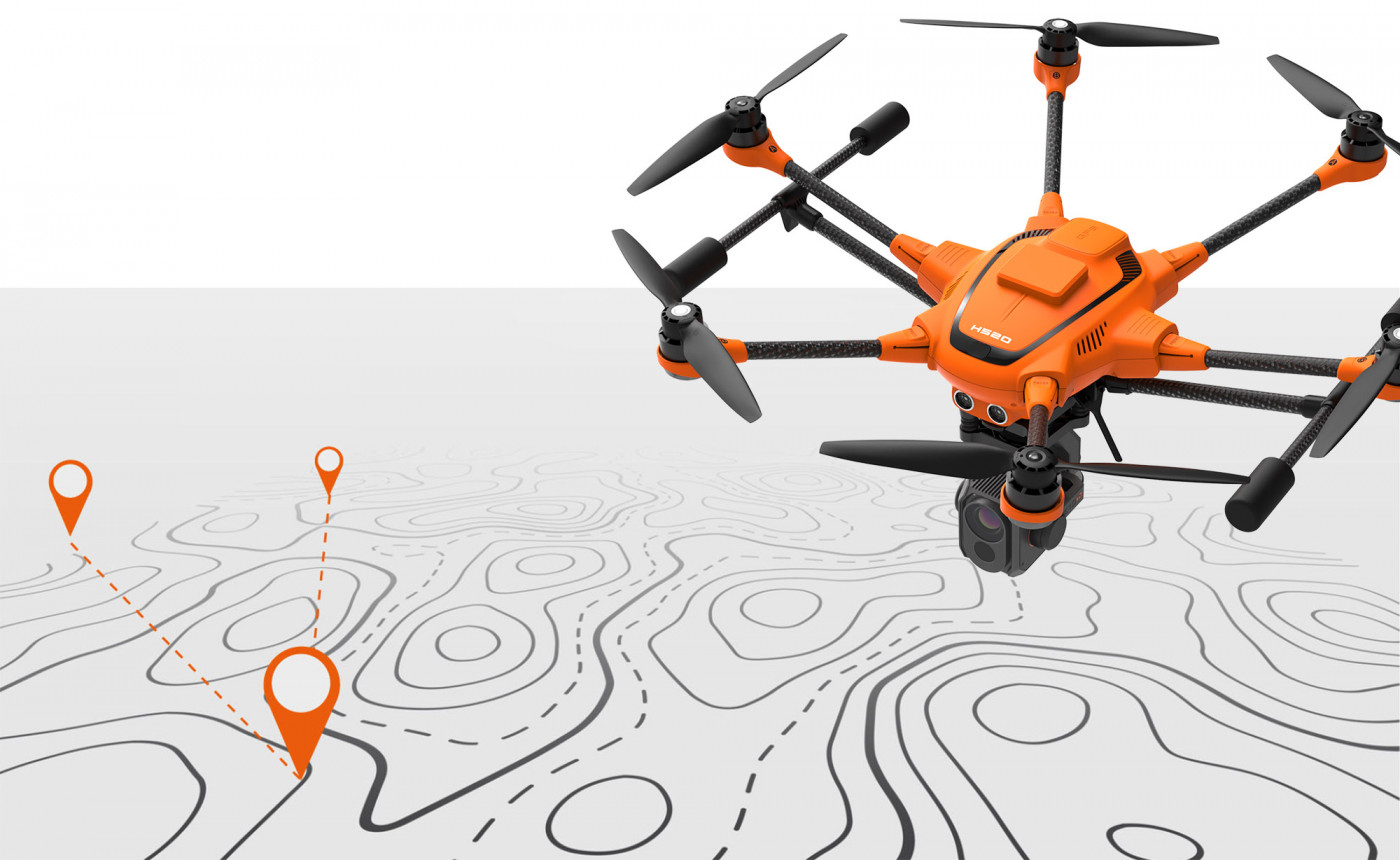
The RTK system is a very important part in those commercial applications that require the highest precision. A classic field of application is 3D mapping, for example with programs Pix4D, Dronedeploy or Altizure. With the help of RTK, a significantly smaller image overlap occurs, which means that fewer photos are needed and, therefore, less flight and calculation time. Inspections can be done much closer to the target because the location of the drone will be accurate to the centimeter. Precision with great advantage when comparing several images taken on different days.
Ready for the mission
The RTK module allows accurate positioning even in difficult environments and is fully integrated into the H520, both hardware and software. This means that it retains the full range of functions of the award-winning Data-Pilot software. All data, including raw GNSS data, can be recorded on board. The system is also prepared for PPK (Post Processed Kinematics or Post-Processed Kinematics)
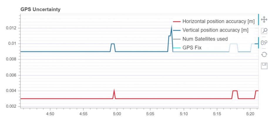
- RTK module (Real-time kinematics) for high precision relative positioning: Horizontal: 1 cm + ppm / Vertical: 1.5 cm + ppm
- Maintains centimeter accuracy even in difficult GNSS environments (eg, between tall buildings)
- For faster and more accurate mapping (for example, complex surveys, inspections, 3D mapping)
- Update frequency of 5 Hz of position, speed and time.
- Fully integrated in the YUNEEC H520
- All data, including raw GNSS data and those obtained in real time, can be recorded, and are ready for PPK (Post-Processed Kinematics)
- Supports GNSS signals of up to 3 satellites between GPS, GLONASS, Galileo and BeiDou
- Compatible with Yuneec TBC H520
- Accurate RTK network or base station
- RTK module available separately or already integrated in the H520 (the purchase of the module separately requires professional installation by the Yuneec technical team)
Accessories
 Battery Li-Po 4 for Typhoon H520
 Battery-ST16S
 Folding arm bracket A for Yuneec H520
 Folding arm bracket B for Yuneec H520
 Typhoon H520 USB Cable
 Yuneec camera filming E 50
 Professional Camera 20 Mpx 4K, 60 FPS Yuneec E90
 Smart Charger for Yuneec H520
 Belt for the ST16 Control Collar
 Dron Yuneec H520 Rigid Case
 BL Motor for Yuneec H520
 RX Module for Yuneec H520
 GPS Module for Yuneec H520
 Integral transmitter ST16S h520
 GPS base station for H520 yuneec RTK
 Yuneec E10TvR 640p radiometric high thermal resolution camera with low luminosity dual lens, 640x512
We also recommend
 |
 |
Customers who bought this product also bought
 |
Browse this category: Yuneec UAV
")
")
")
")